
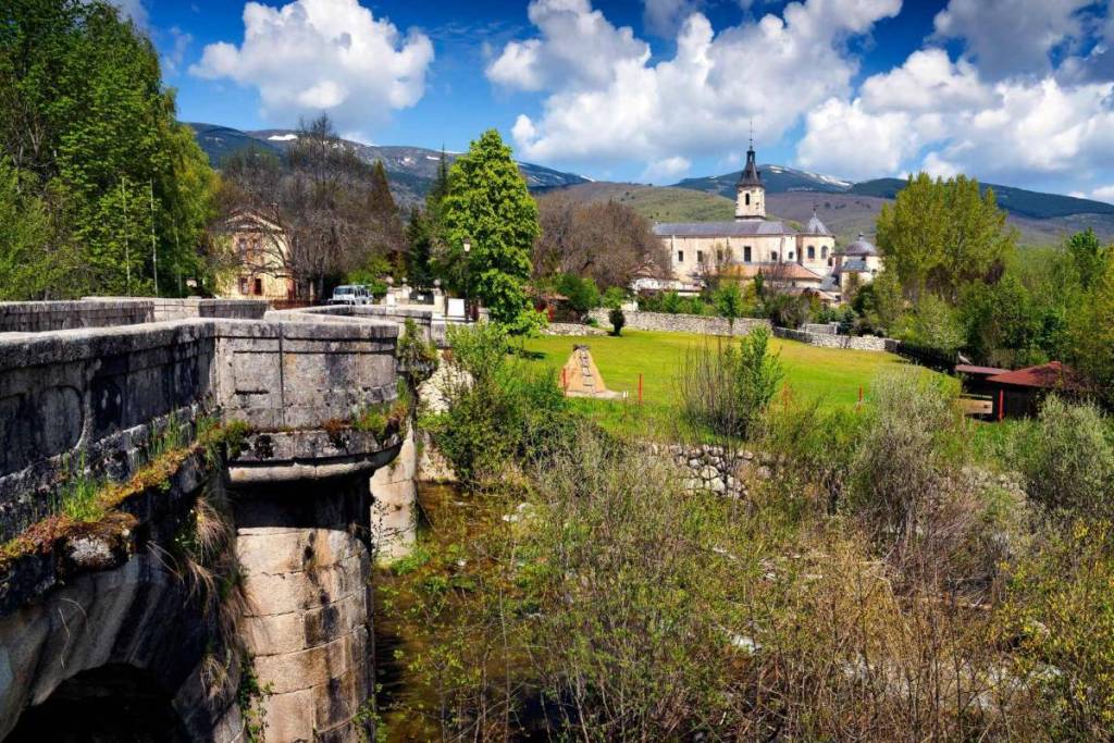

The Sierra Norte de Madrid is one of the region’s major nature reserves, but the trails along its main hiking routes are not always accessible to all visitors. To expand access to its landscapes, the Community of Madrid has adapted nine itineraries with resources that make it easier for people with physical, visual, hearing, or cognitive disabilities to visit. The result is a network of trails where the landscape can also be explored through relief maps, information in Braille, audio guides, videos in Spanish Sign Language, and Easy-to-Read texts.
The initiative is not designed solely for those who use wheelchairs or require specific assistance. It also opens up new possibilities for families with strollers, older adults, visitors who prefer routes with minimal elevation changes, and anyone looking for a peaceful outing in nature. Among the nine routes are walks along the Lozoya River, rural paths through vineyards and olive groves, holm oak pastures, lagoons, mountain villages, and an old 18th-century hydraulic structure.
The initiative is based on a very simple idea: enjoying nature should be possible for more people. According to data from the Community of Madrid, about 10% of the population has an essential need for accessibility measures, while up to 40% benefit from them at some point.
From the Lozoya River to a mountain lake

Among the most attractive options is the trail connecting Rascafría with the area around El Paular. The trail follows the Lozoya River and offers a comfortable way to explore one of the best-known landscapes of the Sierra de Guadarrama without having to tackle a demanding mountain hike.
For those looking for an outing more closely connected to nature and archaeology, the Lozoya Valley Nature Trail offers a section between Lozoya and Pinilla del Valle, alongside the reservoir. The landscape of ash trees, meadows, and mountains is complemented by the proximity of the Valley of the Neanderthals, home to some of the region’s most significant archaeological sites.
Another option for a more leisurely pace is in Prádena del Rincón. The Senda del Agua trail leads to the Salmoral lagoon, a small body of water featuring a bird observatory, wildlife shelters, and a geological garden. It’s a great getaway for families who want to take a short walk, go birdwatching, and discover how the granite landforms in this part of the mountain range were formed.
Canals, Villages, and Pastures
The Sierra Norte is not just forests and mountains. It also preserves trails linked to agriculture, water, and villages. One of the most unique follows the old Cabarrús Canal, a hydraulic infrastructure built in the late 18th century to carry water between the Lozoya and Jarama river basins.
The canal, designed to facilitate the agricultural use of water, once featured bridges, aqueducts, guardhouses, and irrigation ditches. Although it ceased to function in the 19th century, it still offers insights into the region through the history of engineering and rural labor. The tour can be rounded out with a visit to Torremocha del Jarama and its Museum of Agriculture.
In the same area, the Camino de las Huertas connects Patones de Abajo with Torremocha through vineyards, olive groves, and grain fields. It offers a different way to experience the Patones area: far from the steep streets and slate-roofed houses of Patones de Arriba, the trail reveals an open landscape of fertile plains, crops, and traditional paths.
There are also very short routes, such as the Callejas de Navalafuente, which allow visitors to explore the village among ash trees, stone walls, and historic paths, or the “Senda para Todos” (Trail for Everyone) in Redueña, which crosses a communal pastureland of holm oaks, gall oaks, and junipers.
The Montejo Beech Forest, by reservation

The Montejo Beech Forest is probably the best-known site in this network. Its accessible trail allows visitors to explore one of the southernmost beech forests in Europe, located within the Sierra del Rincón Biosphere Reserve. In the fall, the forest becomes one of the most popular destinations in the Community of Madrid thanks to the colors of its leaves, although the site remains interesting year-round.
The visit requires planning. Access is regulated to protect this ecosystem and takes place in small, guided groups, so it’s necessary to make a reservation before heading out. It’s not something you can plan on the spur of the moment, but it is one of the most special getaways you can take from Madrid—provided you can secure a spot.
A Getaway Without a Car
Several of the routes make it possible to plan outings without a private vehicle, provided the trip is well planned. The route between Lozoyuela and Sieteiglesias, for example, connects two towns through holm oak forests, meadows, and rural trails that can be reached by taking bus 191.
From Madrid, connections to the Sierra Norte depart mainly from the Plaza de Castilla transit hub, such as bus 194, which goes to Rascafría. However, schedules may be limited and vary depending on the municipality, the day of the week, or the season. Before setting out, it is essential to check not only the outbound route but also the last return bus.
Before setting out
These routes offer different levels of accessibility, so it’s best not to assume that all of them are equally suitable for every need. Before heading out, be sure to check the official website for details on your chosen route, including its length, surface type, elevation gain, available accessibility resources, the weather forecast, and actual public transportation options.
Bringing water, a charged cell phone battery, appropriate clothing, and comfortable footwear remains important, even on the easiest trails. In mountainous areas, the weather can change quickly, and some trails may have mud, rocks, or uneven sections after rain.